Maya ruins · Tulum
Tulum ruins & cenotes: a visitor's guide to the clifftop Maya city
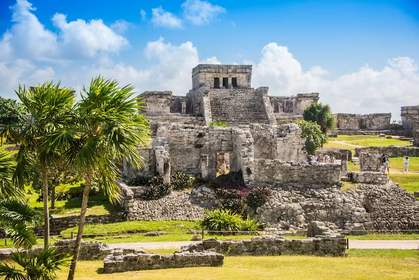
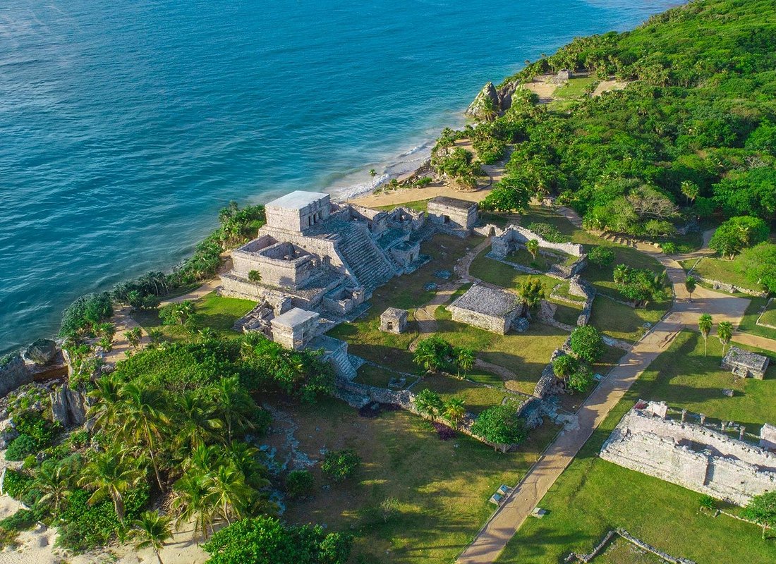
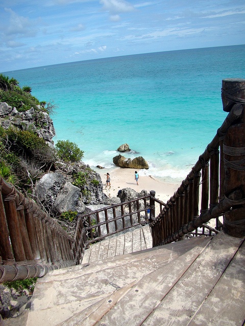
El Castillo stands on the cliff edge above the Caribbean, the most photographed view in Tulum.
- The activity
- The ruins of an ancient walled Maya port city on limestone cliffs above the Caribbean, the only major coastal Maya site in Mexico. Most visitors see it as part of a day that also takes in Yal-kú Lagoon and a cenote.
- Location
- Tulum, Quintana Roo, off Highway 307. About two hours from Cancún and an hour from Playa del Carmen.
- Duration
- One to two hours on the site itself, longer with a guide or a walk down to the shore. A combined day tour with the lagoon and a cenote runs eight hours or more door to door.
- Best time to arrive
- At opening, around 8am, before the heat and the coach parties.
- Admission cost
- Around $35 per person at the gate, and not usually included in a tour price. Bring a refillable bottle, as single-use plastic is banned on site.
What to expect
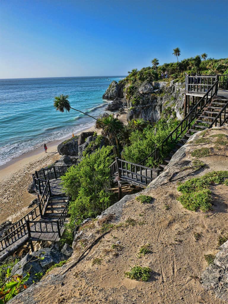
The Tulum ruins are the most striking archaeological site on the Riviera Maya, and the only major Maya city built directly on the coast. Where most ancient sites sit inland, swallowed by jungle, Tulum occupies a low cliff above the open Caribbean, its grey stone temples set against the sea and the sky. That setting, as much as the architecture, is what draws visitors from across the region.
The site is compact and easily walked. El Castillo, the largest structure, sits on the cliff edge and served historically as both temple and navigational beacon for canoes approaching the reef. The Temple of the Frescoes holds the best-preserved murals on the site, and the Temple of the Descending God is named for the winged figure carved above its doorway, a motif repeated across the city.
The four-stop day, and what it includes
Most visitors reach the ruins on a combined day tour rather than alone, because the site itself occupies under two hours and the drive is long enough to justify filling the rest of the day. This tour is rated 4.9 across more than 1,900 reviews. It pairs the archaeology with two swims and a beach club, and the itinerary is worth understanding before booking.
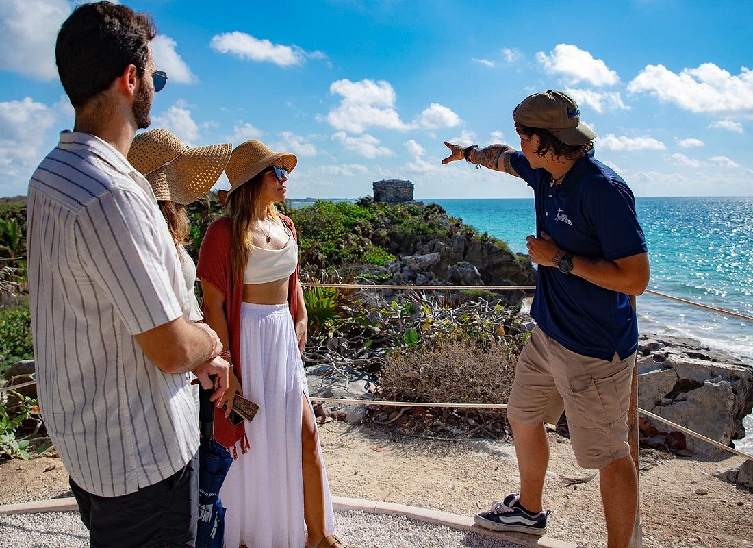
The day runs in four parts. Two hours at the Tulum archaeological site with a bilingual guide; an hour snorkelling at Yal-kú Lagoon near Akumal, where spring water meets the sea in a sheltered, brackish inlet full of reef fish; an hour at Cenote El Sueño, a cavern swim among stalactites that reviewers routinely name the highlight of the day; and an hour at the Punta Venado beach club for lunch. Round-trip hotel transport, the guide, snorkelling gear, life jackets, snacks and the admissions to the lagoon and the cenote are included. Groups are capped at sixteen.
Three practical points are worth knowing before you book. The Tulum site admission of $35 is not included and is collected at the gate. Towels are not provided, which after two cold-water swims is the detail most worth planning for. And the published duration of six and a half hours describes the activities rather than the day: with pickup and return, most reviewers report eight to eleven hours door to door, with lunch arriving as late as four in the afternoon.
One further condition catches people out. Personal cameras and phones are not permitted inside the cenote. An on-site photographer sells packages instead, and the restriction applies whether or not you buy. Bring a refillable bottle as well, since single-use plastic is banned within the archaeological site.
Yal-kú Lagoon: where the fresh water meets the sea
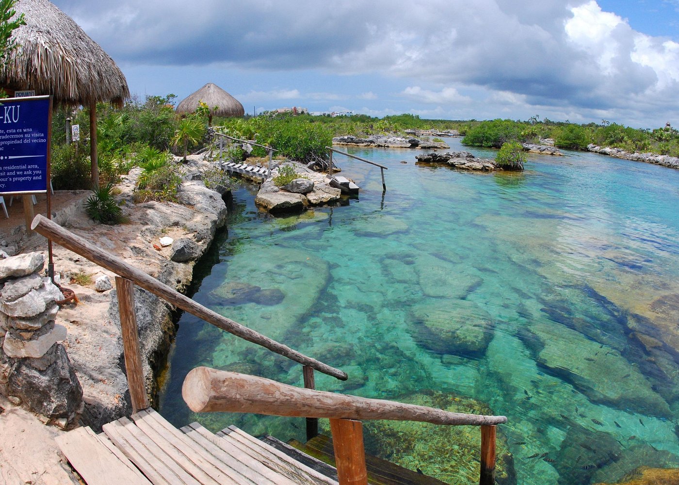
Yal-kú sits at the northern end of Akumal, a narrow inlet where underground rivers surface and drain into the Caribbean. The result is brackish water, part fresh and part salt, and it produces the lagoon's defining feature: a visible shimmer in the water column where the two meet, called a halocline, which distorts the view beneath you as though looking through warped glass.
The swimming is calm and shallow, enclosed by low limestone outcrops that keep the swell out entirely, which makes it one of the gentler snorkelling sites on the coast and a reasonable choice for children or hesitant swimmers. Life jackets are provided and generally required. Snorkelling is worthwhile here. You can find parrotfish, sergeant majors, angelfish and needlefish, which gather in numbers in the sheltered water, and the visibility is good.
The water is noticeably cooler than the open sea, because a proportion of it arrives from underground. There is no coral here either, so this is a site of fish and rock formations rather than a reef. Sunscreen is prohibited here, as it is at every cenote and spring-fed site in the region.
Cenote El Sueño: the swim most people remember
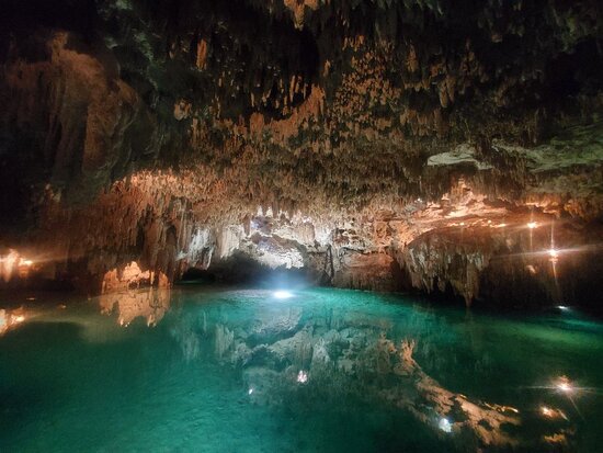
The cenote is the stop reviewers most often name as the highlight of the day. Cenote El Sueño is a cavern site, so you swim inside a partially enclosed chamber rather than an open pool, with stalactites descending towards the surface and daylight entering through the opening above.
The water is fresh, still and cold, filtered through limestone and clear enough that the floor stays visible well below you. Wooden steps lead down into the chamber, life jackets are provided, and the swim is short by design, around an hour including changing. The temperature is what everyone notices first, and the sensation of swimming in an enclosed chamber beneath the rock is what stays with them afterwards.
Practical conditions apply and are enforced. You must rinse before entering, and no sunscreen, insect repellent or cosmetics of any kind are permitted, since the water feeds a living aquifer that supplies the region. Cameras and phones are not allowed inside; an on-site photographer sells packages instead. Towels are not provided on this tour, so bring your own. With two swims in the day, it is the one item worth remembering.
The honest takeaway on the ruins
Visitor reviews of the Tulum ruins are consistent. The setting is almost universally praised, while the heat and the crowds are what visitors find difficult.
What visitors praise about the site
- The setting is the draw. Reviewers consistently rate the cliff-top position above the sea as the finest of any Maya site.
- Compact and manageable. The whole site is walkable in an hour or two, which suits families and shorter visits.
- Guides are well reviewed. Visitors who take a guide report getting considerably more from the ruins than those who walk them alone.
- Resident iguanas. A small thing, but a recurring favourite in reviews, particularly with children.
What visitors find difficult
- Heat and almost no shade. The most important thing to plan around. The site is open ground and becomes punishing by midday.
- Crowds build quickly. Reviewers describe a marked difference between the first hour after opening and late morning.
- The approach is commercial. The walk from the car park passes a run of stalls and persistent tour touts before you reach the gate.
- Structures are roped off. Buildings are viewed from paths rather than entered, which some visitors find limiting.
This assessment covers the archaeological site itself, not the tour that reaches it. Drawn from the recurring themes in public visitor reviews of the site. We do not reproduce individual reviews or aggregate scores; for current ratings, check Viator or another booking platform directly.
Getting there
The entrance sits just off Highway 307 at the northern edge of Tulum town. Driving is straightforward and the turn-off is signposted; arrive early to secure a space in the car park, as it fills through the morning. Colectivos running the Playa del Carmen to Tulum route will drop you at the junction, from where it is a walk of several minutes to the ticket gate. Organised tours collect from hotels across Cancún and the Riviera Maya.
How to make the most of the day
- 1Book the earliest departure available. Pickup times are set by the operator and depend on your hotel, so the earliest slot is what gets you to the ruins before the heat and the coach parties build.
- 2Bring water, a hat and sun cream. There is very little shade on the site, and a refillable bottle is required since single-use plastic is banned inside the archaeological zone.
- 3Carry the $35 site admission in cash. It is collected at the gate rather than included in the tour price, and cash is the reliable way to pay.
- 4Pack a towel and a dry bag. The tour includes two swims and towels are not provided. A dry bag is useful at the cenote, where phones are not permitted in the water.
- 5Save it for a poor beach day. When sargassum is heavy along the coast, the ruins and the cenote are unaffected, which makes this the most reliable fallback plan in the region.
The history, in more depth
Tulum flourished late in the Maya timeline, principally between the 13th and 15th centuries, when it served as a walled port and trading hub for the powerful inland cities. Its original name is thought to have been Zamá, meaning "dawn," a fitting label for a settlement that faces the sunrise over the sea. Goods such as jade, obsidian, cotton and salt moved through its harbour along coastal and overland trade routes. The site remained occupied for several decades after European contact before it was eventually abandoned.
A defensive wall on three landward sides, with the cliff guarding the fourth, gives Tulum its name, which translates loosely as "wall" or "enclosure." That fortification is unusual among Maya sites, and it tells you how valuable the port once was. The wall encloses the ceremonial core, while the bulk of the population would have lived beyond it in dwellings built of perishable materials that have long since disappeared.
The recurring figure of the descending god, carved head-down above doorways across the city, has never been conclusively identified. Interpretations range from a rain or maize deity to a representation of the setting sun or the planet Venus, which the Maya tracked with considerable precision. Whatever its meaning, it appears often enough at Tulum to suggest particular local significance.
Tulum's harbour connected it to a maritime network running the length of the eastern Yucatán coast, from Isla Cozumel down towards present-day Belize and Honduras. Canoes hugged the reef line, and El Castillo's position, visible from well out to sea, is widely read as a deliberate navigational marker guiding them through a gap in the barrier reef towards safe landing.
Some links to tours and activities are affiliate links. If you book through them, Sargazo Watch may earn a small commission at no extra cost to you.