Sargassum barriers in the Riviera Maya
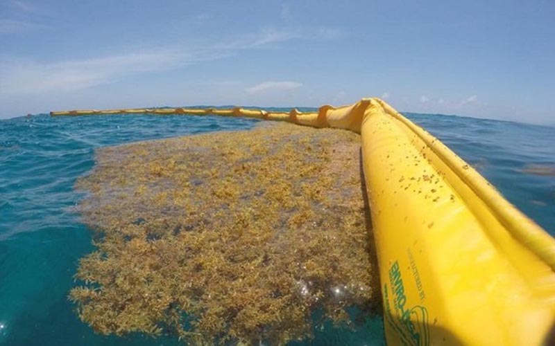
An offshore containment barrier trapping sargassum on its seaward side, before it can reach the sand.
Along the most affected stretches of the Mexican Caribbean, the first line of defence against sargassum is a floating fence. These offshore barriers, known in Spanish as barreras antisargazo, are anchored a few hundred metres out and are designed to catch the seaweed at sea, where boats can collect it, before it reaches the beach and begins to rot. They are the most visible part of a much larger containment effort, and they are also the most misunderstood.
A barrier is not a guarantee of clear water. Its performance depends heavily on the strength of the currents, the direction of the wind, the size of the swell and how quickly crews empty the seaweed that piles up behind it. This guide sets out where the main barriers are, which organisations installed each one, and an honest assessment of how well the beach behind it tends to stay clear.
How a barrier actually works: a buoyant tube floats on the surface with a mesh or fabric skirt hanging below it. Sargassum floats, so it collects against the seaward face of the skirt rather than passing underneath. Purpose-built booms hold far more biomass than improvised ones, but any barrier can be overtopped by a big swell or dragged loose in a storm, which is why a meaningful share of the deployed material is lost and replaced every year.
The state programme behind most of the barriers
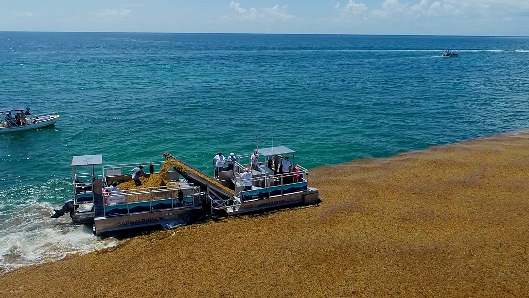
The large public barriers are not installed by individual towns acting alone. They are part of a coordinated state strategy led by the Quintana Roo Secretariat of Ecology and Environment (SEMA), working with the Mexican Navy (SEMAR), which handles the actual at-sea installation and collection, alongside municipal beach crews and, increasingly, the hotel sector.
The scale has grown sharply. During the 2025 season the Navy reported around 7,500 metres of barrier active along the coast, and the state's year-end figure was about 9.5 kilometres installed across the year. For 2026 the state acquired a further 7,500 metres, aiming for a total in the region of 16 kilometres of coverage. Installation typically runs behind that target through the season: as of early July 2026 roughly 9,450 metres were in the water, distributed across Puerto Morelos, Playa del Carmen, Tulum and Mahahual, with the remainder still to be placed.
Why some coastlines get hit hardest: sargassum reaches the Quintana Roo coast along two main current routes, one running past Mahahual and Xcalak in the far south, and one through the channel between Cozumel and Tulum. This is why Tulum, Playa del Carmen and Puerto Morelos consistently record the heaviest landings, and why the barrier programme concentrates its material there.
For deeper background on the containment effort as a whole, including collection boats, beach cleaning and the wider debate about reuse, see our companion piece: what can we do about sargassum?
Puerto Morelos
Installed by: The municipality of Puerto Morelos with the Mexican Navy (SEMAR) and the Quintana Roo state government, supported by a highly organised local community.
Where exactly: Off the downtown public beach (Puerto Morelos Centro), running along the sheltered strip on either side of the main town pier and central square, inside the reef lagoon.
How effective it seems: The strongest performer on the coast.
Puerto Morelos has become the reference point for what a barrier can achieve when everything else is working in its favour. The town benefits from a rare combination of advantages: a natural barrier reef roughly 500 metres offshore that already reduces wave energy and intercepts some seaweed, a substantial offshore boom maintained by the Navy, and a genuinely coordinated cleanup operation on land.
That land operation is significant in its own right. In peak season the municipality fields dozens of beach workers with sweepers and backhoes, while the Navy contributes personnel and a small fleet of pontoon boats whose specific job is to empty the seaweed trapped behind the barrier before it can accumulate and break through. Local officials are careful to credit favourable ocean currents as well, but the practical result is that Puerto Morelos Centro frequently stays swimmable when neighbouring destinations are struggling. It is not sargassum-free, and a strong easterly push can still overwhelm the system for a day or two, but it recovers faster than anywhere else on this stretch.
Playa del Carmen
Installed by: The municipality of Solidaridad with the Mexican Navy (SEMAR), plus separate barriers paid for by individual hotels.
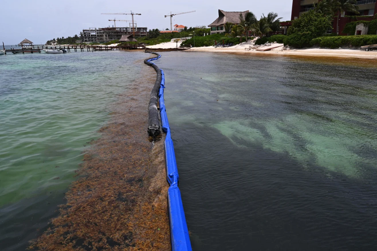
Where exactly: The barrier is concentrated in the central beach area around Playa Fundadores, beside the Cozumel ferry pier, with its anchored core running along the downtown beaches on either side of the pier. State authorities have announced plans to extend coverage further north along the coast toward Punta Esmeralda, with the first stage confirmed from the ferry pier to the Avenida Constituyentes pier. Separately, several northern hotels have installed their own barriers in front of their beaches, including Paradisus, Reef Coco Beach at Playa 88, and Grand Coral near Punta Esmeralda, with Wyndham Alltra and Velas also reported to be adding their own containment.
How effective it seems: Mixed, and highly dependent on the specific beach and the day.
The central section is one of the more substantial barriers on the coast, and the state has described extending it for the 2026 season. In practice its results are inconsistent: Playa del Carmen sits on one of the heaviest sargassum-entry routes, so even the central beaches around Fundadores and the ferry pier are frequently covered despite the barrier, and a boom only helps when crews keep pace emptying it.
The reality across the wider town is more uneven. Playa del Carmen sits squarely on the Cozumel–Tulum entry route, so the volume of incoming seaweed is high, and the barrier is only as good as the collection keeping pace behind it. The central downtown beaches are prioritised and cleared quickly; quieter stretches further north can still accumulate. The barriers here have also drawn a measure of local debate, with some residents welcoming the cleaner sand and others raising concerns about the effect of the structures on nearshore marine life.
Tulum
Installed by: The municipality of Tulum with the Mexican Navy (SEMAR) and the Quintana Roo state government.
Where exactly: Along the beach of the Tulum hotel zone (Zona Hotelera), the exposed coast-road stretch south of the town centre that faces the Cozumel–Tulum channel.
How effective it seems: The hardest coastline to protect, and results reflect that.
Tulum is the most exposed of the major destinations. It sits directly in the path of the Cozumel–Tulum current channel, and its long beach faces the open Atlantic with no protecting reef or bay. It is not new to barriers: a roughly 2.4-kilometre offshore barrier was installed around the Tulum National Park area in 2022, and containment has remained part of the protection system since. As of early July 2026, official figures put roughly 2,300 metres of barrier in place off Tulum, a share comparable to Puerto Morelos, Playa del Carmen and Mahahual.
Even so, an open, high-energy shoreline is precisely the environment in which floating barriers struggle most. Strong swells can push seaweed over the top of a boom or tear it from its anchors, and the sheer volume arriving during a heavy landing can exceed what any barrier and collection fleet can process. Tulum's barriers help at the margins and on calmer days, but this is the stretch where you should lean most heavily on live conditions before committing to a specific beach.
A barrier changes the odds. It does not change the ocean.
Mahahual
Installed by: The Mexican Navy (SEMAR) with the Quintana Roo state government, in the municipality of Othón P. Blanco.
Where exactly: Directly off the town's main beach and malecón, on the exposed south-coast stretch fed by the Mahahual–Xcalak current corridor.
How effective it seems: A meaningful catch on a very exposed southern coast.
Far to the south, Mahahual received one of Quintana Roo's largest anti-sargassum barrier deployments, with approximately 2.3 km installed offshore. Located on the Costa Maya, it is among the first Mexican coastlines reached by sargassum drifting in from the Caribbean. During typical conditions, the barrier helps concentrate floating seaweed offshore, allowing collection vessels to remove it before it reaches the beach, although its effectiveness varies with winds, waves, and the intensity of each influx.
Cancún
Installed by: Under evaluation by the Quintana Roo state government, the Mexican Navy (SEMAR) and the municipality of Benito Juárez.
Where exactly: Trials have centred on the more exposed Playa Coral area rather than the sheltered Bahía de Mujeres beaches; placement is still experimental.
How effective it seems: Not yet a settled question.
Cancún is a more complicated case. Much of its Hotel Zone sits inside the sheltered Bahía de Mujeres and faces relatively little sargassum to begin with, so large barriers have historically been concentrated elsewhere. Where officials have looked at adding one, notably around the more exposed Playa Coral area, the decision has been held up by the strength of the local marine currents, which make anchoring difficult and require sign-off from the Navy on new mooring systems. A modest length of barrier has been earmarked for the city, but at the time of writing its placement remains provisional rather than confirmed.
Private hotel barriers
Installed by: Individual resorts, at their own expense.
Where exactly: In front of individual resorts on stretches outside the main municipal lines, including the northern Playa del Carmen hotels (Paradisus, Reef Coco Beach at Playa 88, Grand Coral), the planned private barrier at Puerto Aventuras, and resort nets further south such as Grand Sirenis Riviera Maya near Akumal.
How effective they seem: Useful in calm conditions, unreliable in very poor conditions.
Separate from the public programme, a number of resorts have installed their own barriers directly in front of their beaches. Grand Sirenis Riviera Maya, on the exposed coast near Akumal, runs an offshore net backed by daily manual and mechanical beach cleaning. These private nets can keep a resort's swimming area usable during light to moderate conditions, but they cover a short length of shoreline on an open, east-facing coast, so a strong onshore wind will still push seaweed through or around them.
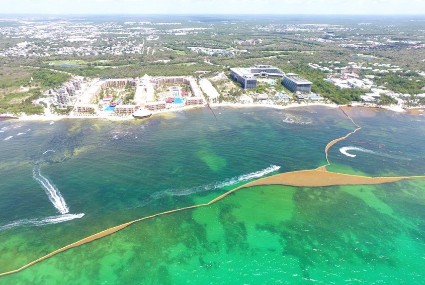
The state has floated the idea of linking some of these private hotel barriers to the public ones in places such as Playa del Carmen and Puerto Morelos, to create longer, better-anchored continuous lines. If that happens, the distinction between hotel and government barriers will begin to blur into a single coordinated system.
The honest summary: barriers work best where three things line up, a sheltered or reef-protected setting, a well-anchored high-specification boom, and a cleanup crew emptying it constantly. Puerto Morelos has all three and shows it. On open coasts like Tulum, and on quieter stretches anywhere, a barrier reduces the problem without solving it. Treat the presence of a barrier as a positive signal, not a promise.
What this means for your trip
If clear water is your priority and you want the reassurance of active management, Puerto Morelos Centro is the most dependable choice on the mainland barrier coast. Playa del Carmen and Tulum are more heavily affected, and their barriers are not currently sufficient to keep the beaches clear on their own; the state is working with the Navy, and with the hotels, to strengthen and extend the containment there, but for now both reward flexibility and a close eye on the forecast. And regardless of where you are headed, remember that the islands and lagoons covered in our guide to where to go to avoid sargassum avoid the problem by geography rather than by barrier.
Before you book or travel: open the Forecast page for the daily satellite outlook, then use the live beach map to check current conditions and barrier locations at the exact beach you have in mind.
Barrier lengths and locations are drawn from public statements by Quintana Roo state authorities and the Mexican Navy during the 2025 and 2026 seasons and change through the year as material is added, moved and replaced. Some links to hotels and activities are affiliate links; if you book through them, Sargazo Watch may earn a small commission at no additional cost to you.