Where to go to avoid sargassum in the Mexican Caribbean
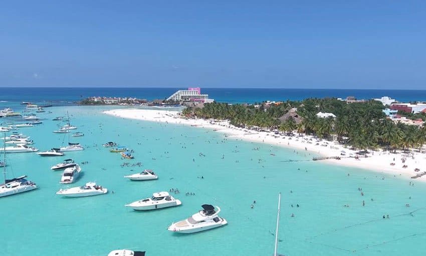
Playa Norte, Isla Mujeres: sheltered, west-facing and consistently among the clearest water in the region.
No destination in the Mexican Caribbean can be guaranteed sargassum-free. The seaweed is carried by open-ocean currents and conditions can shift within days. That said, geography matters a great deal: islands, sheltered bays, west-facing shores and inland lagoons are consistently less exposed than the open, east-facing beaches of the mainland.
This guide focuses on the three destinations that most reliably offer clear water: Isla Mujeres, Cozumel and Bacalar, followed by a set of mainland beaches where conditions vary more, but which are still worth considering. For every location, remember the same principle: check the live forecast and beach map close to your travel dates before committing.
Why orientation matters: sargassum drifts in from the open Atlantic to the east. Beaches that face west, sit inside a protected bay or that are shielded by an island or reef tend to accumulate far less of it than exposed, east-facing mainland shores.
Isla Mujeres
Isla Mujeres is a narrow limestone island roughly 7 kilometres long and, at points, only a few hundred metres wide. It lies about 13 kilometres off the coast of Cancún, across the sheltered Bahía de Mujeres. The island's compact scale and its position relative to the mainland are precisely what make its flagship beach so reliably calm and clear.
A brief history
The island was a sacred site for the Maya, dedicated to Ixchel, the goddess associated with the moon, fertility and medicine. When Spanish expedition led by Francisco Hernández de Córdoba arrived in 1517, they found numerous female-form clay figures representing the goddess, and named the place Isla Mujeres, the Island of Women. For centuries afterwards it remained a quiet fishing community and, at times, a refuge for pirates, before tourism reshaped it in the modern era.
How to get there
The island is reached by passenger ferry. The most frequent service runs from Puerto Juárez / Gran Puerto in Cancún and takes roughly 15 to 20 minutes, with departures approximately every half hour through the day. A second, more expensive service operates from several points in the Cancún Hotel Zone. Cars are not necessary on the island; most visitors get around by golf cart, scooter or taxi.
Book your ferry: Reserve ferry tickets to Isla Mujeres →
Playa Norte
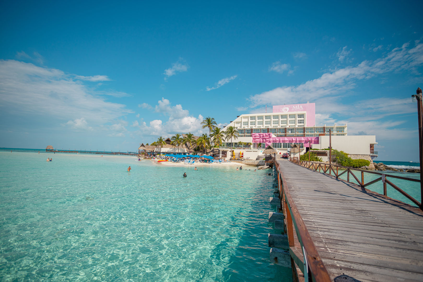
Playa Norte sits at the northern tip of the island and is regularly ranked among the finest beaches in Mexico and the wider Caribbean. The water is shallow for a long way out, the seabed is soft white sand, and there is virtually no surf. These conditions make it ideal for unhurried swimming.
Crucially, Playa Norte faces north and west, into the protected channel between the island and the mainland, rather than out toward the open Atlantic. Because the prevailing currents carry sargassum onto east-facing shores, Playa Norte is shielded from the worst of it and tends to stay clear when mainland beaches are affected. This sheltered orientation, combined with the powdery sand and luminous turquoise colour, is what the beach is famous for.
Punta Sur and Garrafón
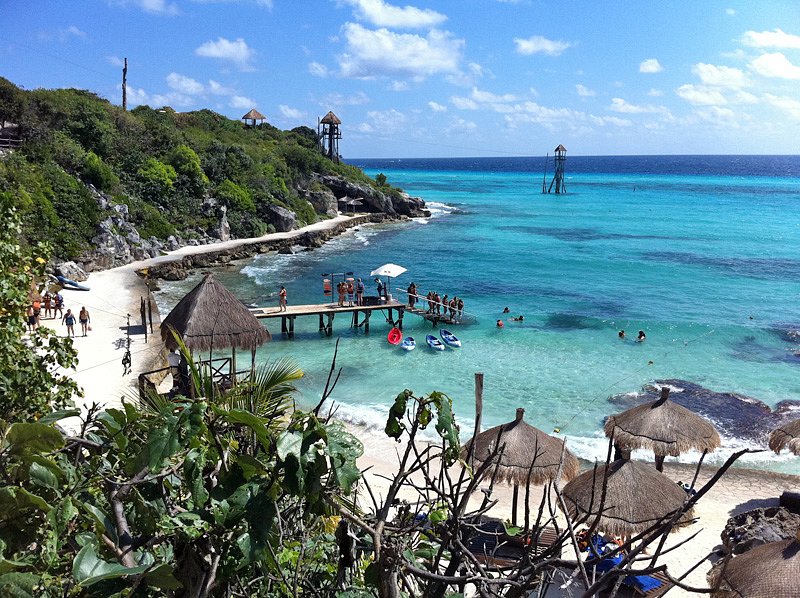
At the opposite, southern end of the island lies Punta Sur, the easternmost point of Mexico and, by extension, one of the first places in the country to see the sunrise. A scenic clifftop walk winds past a contemporary sculpture garden and the modest remains of a Maya temple once dedicated to Ixchel, with sweeping views over the open sea.
Adjacent to the point is Parque Garrafón, a natural reef park set against the island's rocky southern coast. It offers snorkelling over a sheltered reef, ziplines, kayaking and other activities in a single managed setting, a good complement to a beach day at the north end.
Plan an activity: Book Parque Garrafón & the Punta Sur reserve →
Where to stay
Several well-regarded hotels sit directly on or beside the calm northern beaches:
- Mia Reef Isla Mujeres: set on its own private islet at the northern tip, surrounded by sheltered water on both sides.
- Izla Beach Front Hotel: a contemporary beachfront property a short walk from the heart of Playa Norte.
- Privilege Aluxes: an adults-only resort fronting the same sheltered northern shoreline.
Cozumel
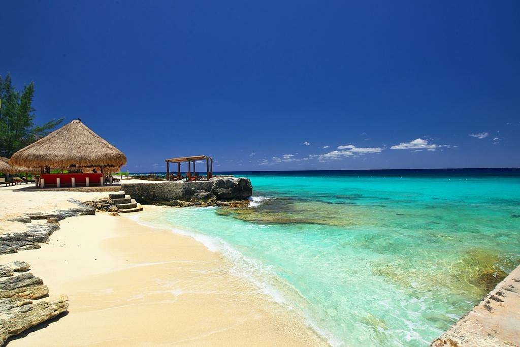
Cozumel is the largest inhabited island in Mexico, roughly 48 kilometres long and 16 kilometres wide, lying about 19 kilometres off Playa del Carmen across the Cozumel Channel. Its main advantage against sargassum is orientation: most of its developed beaches and resorts line the western, leeward coast, which faces the mainland rather than the open Atlantic and is therefore far better protected.
A brief history
Like Isla Mujeres, Cozumel was sacred to the Maya and associated with Ixchel; it was an important pilgrimage destination, particularly for women seeking the goddess's blessing. The island's name derives from the Maya Cuzamil, commonly translated as "land of the swallows." Spanish explorers first reached Cozumel in 1518, and centuries later the island gained worldwide recognition when marine explorer Jacques Cousteau showcased its spectacular coral reefs in the 1960s. His documentaries helped transform Cozumel into one of the world's premier scuba diving destinations, attracting divers from around the globe.
How to get there
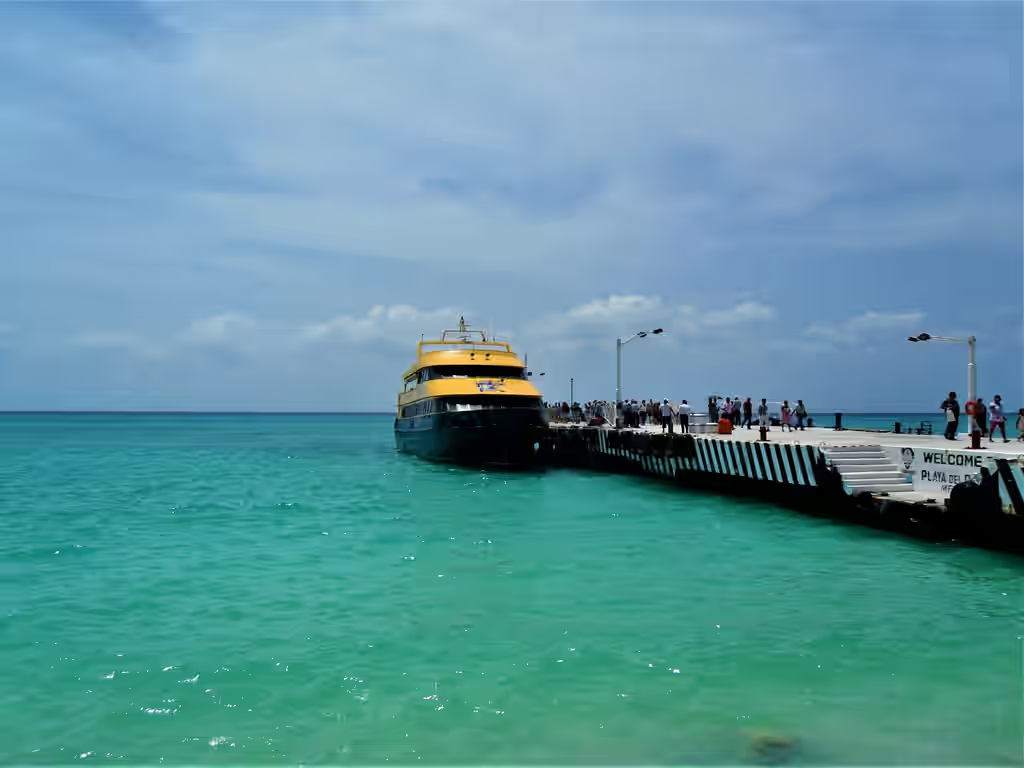
Cozumel is served by frequent passenger ferries from Playa del Carmen, with a crossing time of around 45 minutes and departures roughly every hour. The island also has an international airport. As with Isla Mujeres, a car is not essential, though many visitors rent a vehicle or scooter to explore the quieter southern and eastern coasts.
Book your ferry: Reserve ferry tickets from Playa del Carmen to Cozumel →
The beaches and the reef
The sheltered west coast is where the calm, clear water is found. Offshore lies part of the Mesoamerican Reef, the second-largest barrier reef system in the world, which is the reason snorkelling and diving are the island's defining activities. The eastern, windward side is rugged and exposed, with strong surf and currents that make most of it unsuitable for casual swimming, though it is scenic to drive. Because the populated beaches sit on the protected side, Cozumel generally fares better than the open mainland during sargassum season, although no shore is entirely immune.
Where to stay
- Presidente InterContinental Cozumel: south of town on the leeward coast, with its own beach and house reef.
- Cozumel Palace: an all-inclusive on the waterfront in San Miguel, the island's main town.
- Hotel Cozumel & Resort: a well-priced resort on the west coast, convenient to town and the dive sites.
Bacalar
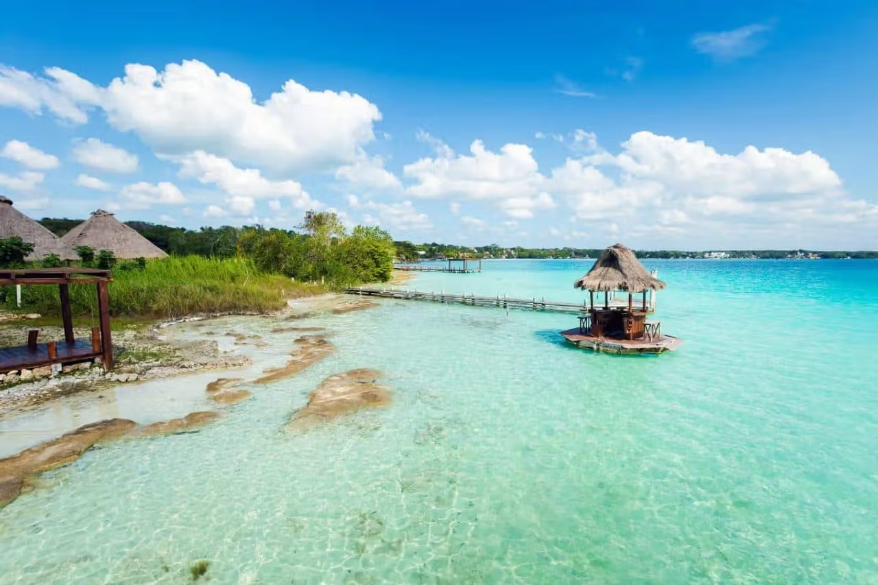
If your priority is clear water with no risk of sargassum whatsoever, Bacalar is the definitive answer, because it is not the ocean at all. Bacalar is a freshwater lagoon in the south of Quintana Roo, near the border with Belize, known as the Laguna de los Siete Colores, or Lagoon of Seven Colors, for the bands of blue and turquoise produced by its white limestone bed and varying depths.
A brief history
The area has deep Maya roots and later became strategically important during the colonial period. The Fort of San Felipe was built in the eighteenth century to defend the settlement against pirate incursions, and still overlooks the lagoon today. Bacalar is now designated a Pueblo Mágico ("Magic Town"), a recognition of its cultural and natural significance.
How to get there
Bacalar is inland and is reached by road rather than ferry. It lies roughly a three-and-a-half to four-hour drive south of Cancún; long-distance buses serve the town directly, and the nearest airport is at Chetumal, about 40 minutes further south. Because it is a longer journey, Bacalar is best treated as a destination in its own right or a multi-day side trip rather than a day excursion.
What to do
Activities centre on the water: swimming, kayaking, paddleboarding and sailboat tours across the lagoon's shifting colours. The area is also home to cenotes and to stromatolites: rare, living rock-like structures formed by some of the earliest known life forms, which are protected and should be treated with care.
Where to stay
- Mía Bacalar Luxury Resort & Spa: a full-service resort set directly on the lagoon shore.
- Habitas Bacalar: a design-led, adults-only retreat on the water's edge.
Mainland beaches where conditions vary
The following beaches are more exposed than the islands and lagoon above, and conditions can change from week to week. They remain worthwhile, each with its own character, but they call for a closer check of live conditions before you go.
Playacar Phase 2, Playa del Carmen
Playacar is a gated residential and resort community immediately south of the Playa del Carmen ferry pier. Its second phase is known for an exceptionally wide, long and uncrowded beach fronted by large all-inclusive resorts, lending it a private, spacious feel. The shore faces east and is therefore exposed to sargassum during the season, but the generous width of the beach and active resort cleanup help maintain usable space even on busier days.
Costa Mujeres, north of Cancún
Costa Mujeres is a newer luxury hotel zone north of Cancún, beyond Punta Sam. Its position on the northern coast gives it a degree of shelter compared with the fully east-facing beaches further south, and the area's recent, low-density development means broad, well-maintained sands. Conditions still vary with the season, but it is a strong option for travellers seeking modern resorts away from the busier Hotel Zone.
Playa Tortugas and Playa Langosta, Cancún
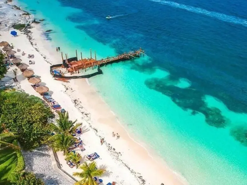
These two public beaches sit at the northern end of the Cancún Hotel Zone, inside the sheltered Bahía de Mujeres. Because they face the bay rather than the open sea, they are often calmer and clearer than the beaches further down the strip, and are recognisable for their two distinct shades of blue. Both are easy to reach and popular with families; Playa Tortugas is also a departure point for boats and water activities.
Playa Delfines, Cancún
Playa Delfines, near kilometre 17.5 of the Hotel Zone, is Cancún's best-known public beach, home to the famous lookout and the large coloured "CANCÚN" sign. With no hotels directly behind it, it offers a wide, open expanse of sand and uninterrupted sea views. It faces the open ocean, so it sees larger waves and is more exposed to sargassum than the bay-side beaches; but its sheer size and dramatic setting keep it a favourite for photographs and long walks.
Geography improves your odds. The live map confirms the reality day to day.
A sargassum-free alternative: the cenotes
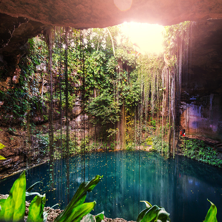
If the sea is rough or sargassum has arrived, the Yucatán Peninsula's cenotes offer a reliable freshwater alternative. These natural sinkholes, formed where the limestone bedrock collapses to reveal the groundwater beneath, range from open pools ringed by jungle to vast underground caverns. The water is exceptionally clear and cool year-round. Considered sacred by the Maya, the cenotes are inland and fed by freshwater, which means they are entirely unaffected by sargassum. Many of the best-known cenotes lie within easy reach of Playa del Carmen and Tulum, making them an ideal half-day excursion.
Plan an excursion: Browse cenote tours in the Riviera Maya →
Before you book or travel: open the Forecast page for the daily satellite outlook, then use the live beach map to check current conditions at the exact beach you have in mind.
Some links to hotels and activities are affiliate links. If you book through them, Sargazo Watch may earn a small commission at no additional cost to you. This helps keep the live map and forecast free to use.