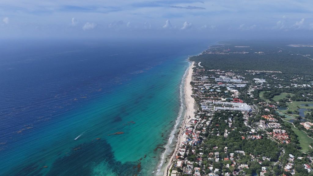
Playa del Carmen has one continuous shoreline, but it is not one beach. From the resorts of Playacar in the south to Punta Esmeralda in the north, the sand is divided by the Cozumel ferry pier, by street accesses and by hotel frontages. Some stretches are more affected by erosion than others, and each section has its own character and its own record with sargassum.
We track the town as separate beaches on the live map, with dated photographs, drone flights and webcams, and we have written a full guide to most of them. This article draws those guides together into a single ranking.
Ranking criteria
Each beach was assessed on four criteria. Beach conditions cover the width and quality of the sand and the clarity of the water. The sargassum record is based on our dated photographs and drone flights over a long period. Access describes how easily a visitor who is not staying on the beach can reach it. Amenities cover the restaurants, beach clubs, toilets, showers and shade available on the beach or close to it.
No beach in Playa del Carmen is protected from sargassum. The town faces east into the open Caribbean, in the path of the current that carries sargassum north-west along the coast of Quintana Roo, and Cozumel, although it lies offshore, does not shelter the town: our photographs show sargassum reaching the town beach in the same way as the open beaches to the south. The beaches therefore differ in how much sargassum they receive, not in whether they receive it, and the ranking is not a guarantee of conditions on a given day.
1. Playacar Fase 2
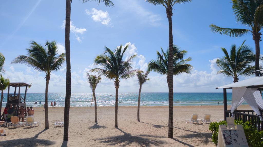
Playacar is the planned development that begins just south of the ferry pier. Its northern section, Fase 1, is mostly a gated community of private villas. Fase 2, further south and larger, is where most of Playacar's all-inclusive resorts stand, laid out around the Playacar golf course, with the beach running along its eastern edge.
Erosion is most visible in Fase 1, particularly near its northern entrance and in front of the residential streets. Walking south into Fase 2, the beach becomes wider and noticeably more attractive. The water has a sandy bottom and a gentle shelf, with gentle to moderate waves depending on the wind. Because land access runs through the resorts and the gated streets, the people on the sand are mostly hotel guests, and the atmosphere is usually calm and family-friendly: most visitors relax on loungers, and a few play volleyball at the resorts' nets.
Its position also works in its favour. Sargassum moving north along the coast tends to collect against the southern side of the ferry pier, in Fase 1, and Fase 2 lies further south, away from that point. Fase 2 is not spared, and receives sargassum like the rest of the town in a heavy arrival, but it generally accumulates less than Fase 1.
Cleaning is a further advantage. The resorts clear sargassum from their own frontages, some with machinery and others by hand, and during a heavy arrival in March 2026 the Navy and Zofemat, the municipal beach authority, also sent crews and a sargassum collection boat to Playacar. The effort varies from one resort to the next, which is one reason conditions can differ along the beach.
Resorts on this stretch include the Riu Palace Riviera Maya, Riu Yucatán, Sandos Playacar, The Reef Playacar and Viva Azteca by Wyndham, where a live webcam shows the beach in real time. The small Maya ruins of Xaman-Ha lie within the Playacar grounds.
Access is the main drawback for anyone not staying here, although the width of the beach repays the effort. The sand is public, as on every beach in Mexico, but there is no public beach car park, and the practical public route is on foot along the beach: from Parque Fundadores, past the ferry pier and south along the sand, about thirty minutes on foot. The alternative is a resort day pass: several resorts on this stretch, among them The Reef Playacar and Sandos Playacar, sell all-inclusive passes that include the beach, the pools, food and drinks.
The amenities on this stretch are those of the resorts, which serve their guests and day-pass holders. A visitor arriving along the sand should bring water and shade.
- Best for
- Resort guests, families, a quiet full day on the sand
- Amenities
- Those of the resorts, for guests and day-pass holders
- Access
- Walk south along the sand from Fundadores, or buy a resort day pass
- Watch for
- Conditions can differ from one resort frontage to the next on the same morning
- Our assessment
- The widest, calmest and quietest beach in Playa del Carmen, and the strongest choice for a stay where the beach is the priority.
Read the full guide to Playacar Fase 2 → · Live card →
2. Playa Mamitas
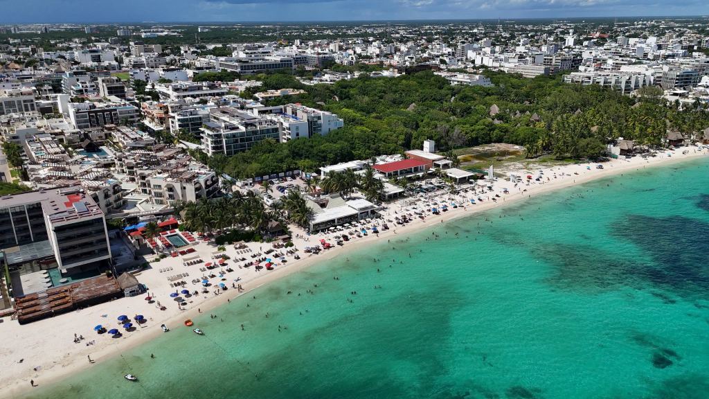
Playa Mamitas is the section of the town beach that runs north from Playa Constituyentes to about Calle 38 Norte, with its centre at Calle 28 Norte, a few blocks north of the busiest part of Fifth Avenue. It is the most popular stretch of sand in Playa del Carmen and is usually crowded, particularly at weekends and in high season.
It is also the most social. On a typical day the sand is shared by families, couples and groups of friends, some on towels and others on hired loungers, and the water is busy with swimmers. The beach takes its name from Mamita's Beach Club, which occupies part of the frontage and remains in operation, with open public sand on either side of it.
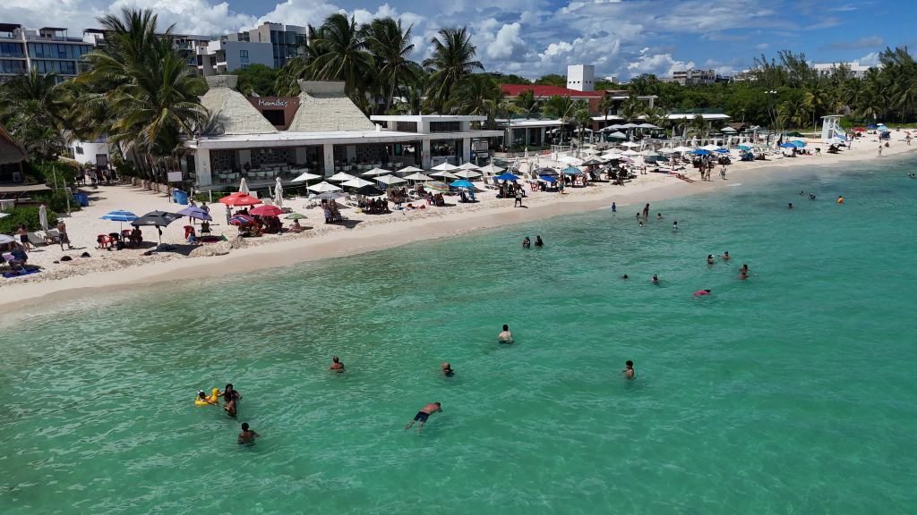
The water is generally calm to moderate, with a sandy bottom and a gentle shelf. Mamitas has one of the better sargassum records in Playa del Carmen: in September and October 2026, our photographs often showed less sargassum from Mamitas to Calle 38 than from Parque Fundadores to Constituyentes.
Mamitas also has more amenities close at hand than any other public beach in the town, with beach clubs on the sand and restaurants in the streets behind it. Music from the beach clubs can be heard in some parts of Mamitas.
- Best for
- A lively day out, beach clubs, swimming close to the centre
- Amenities
- Beach clubs, loungers for hire, restaurants nearby
- Access
- Easy: several public access points from the streets
- Watch for
- Crowds at weekends and in high season
- Our assessment
- The best public beach in the town centre, combining an easy walk from Fifth Avenue with one of the better sargassum records in Playa del Carmen.
Read the full guide to Playa Mamitas → · Live card →
3. Playa Mahekal (Calle 38)
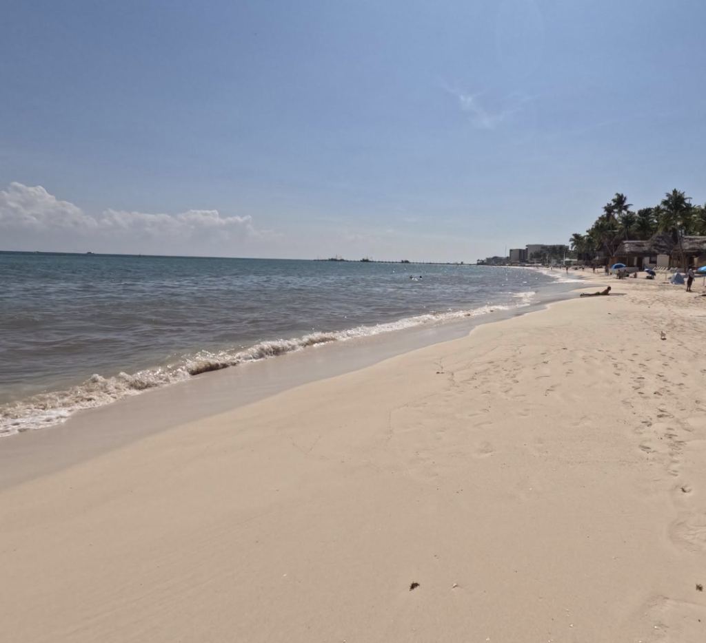
Playa Mahekal, also known as Playa 38, is the stretch of shoreline at the end of Calle 38 Norte, north of the town centre. It takes its everyday name from Mahekal Beach Resort, which stands on the beach at the foot of the street.
The beach lies at the end of Calle 38, one of the best-known streets in Playa del Carmen. It is a short street lined with large trees that shade its open-air restaurants, cafés and bars, and it is noticeably more relaxed than Fifth Avenue.
It shares Mamitas's position on the coast, and with it the better record of the northern half of the centre, but it has fewer people on the sand. Like Mamitas, it is well served by beach clubs and restaurants, and the stretch just north of it can be noisier than Mamitas: Encanto Beach Club stands at Calle 40, Martina Beach Club at Calle 44 and Mandarino Beach Club a little further north at Avenida CTM. It remains within walking distance of Fifth Avenue, so it offers a less crowded beach without moving away from the town. The swim is easy on a normal day, with a sandy bottom and modest surf, and Cozumel is visible across the water on a clear day.
The sand in front of the hotels is cleared, so the beach can look tidy while there is still sargassum in the water. When checking a photograph of this stretch, the waterline is the part to look at.
- Best for
- Visitors who want the town within reach without the full crowds
- Amenities
- Beach club and hotel services; shops and restaurants a short walk away
- Access
- Easy: a short walk north along Fifth Avenue from the centre
- Watch for
- Beach club music between Calle 40 and Avenida CTM
- Our assessment
- A less crowded alternative to Mamitas, still on a favourable stretch of the town beach.
Read the full guide to Playa Mahekal → · Live card →
4. Playa 88
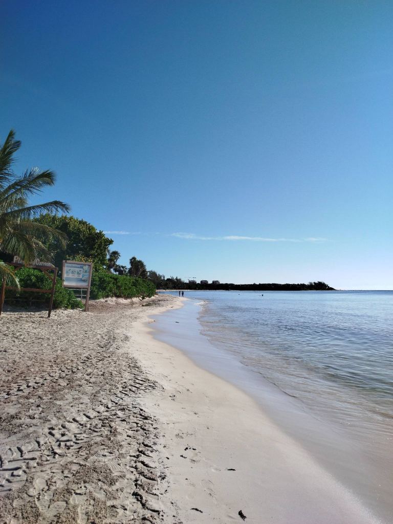
Playa 88 lies at the seaward end of Calle 88 Norte, in Colonia Luis Donaldo Colosio, about three kilometres north of the centre and just south of Punta Esmeralda. It is a free public beach with more facilities than any other public access in the town: toilets, showers and changing rooms, lifeguards and free palapas for shade. A small fee has sometimes been charged for the toilets and showers, so carrying a few coins is sensible.
The approach is a paved corridor for pedestrians and bicycles; cars cannot reach the sand. There are bicycle racks and motorbike parking at the entrance, and a deck path over the sand for wheelchairs and pushchairs. There are no hotels, restaurants or beach clubs on the sand, so food and drink must be carried in, and the visitors are mostly people who live nearby. Pets are not allowed; the town's official dog beach is Playa 72, a short distance to the south. The free palapas are taken early on a busy morning.
Its sargassum record is the weakness that keeps it at fourth place. In September and October 2026, our photographs and drone flights often showed more sargassum from Playa 72 and Playa 88 north to Punta Esmeralda than on the central beaches between Mamitas and Calle 38.
- Best for
- Families who want public facilities, wheelchair users, a beach generally quieter than Mamitas or the beach clubs around Calle 40
- Amenities
- Toilets, showers, changing rooms, lifeguards, free palapas, deck path
- Access
- On foot or by bicycle for the last stretch; taxi or colectivo from the centre
- Watch for
- A weaker sargassum record than the centre in recent months; no food on site
- Our assessment
- The best-equipped public beach in Playa del Carmen, worth choosing on a day when our photographs show the north of the town in good condition.
Read more about Playa 88 → · Live card →
5. Parque Fundadores
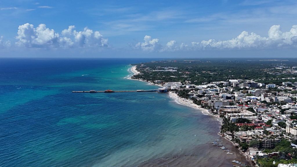
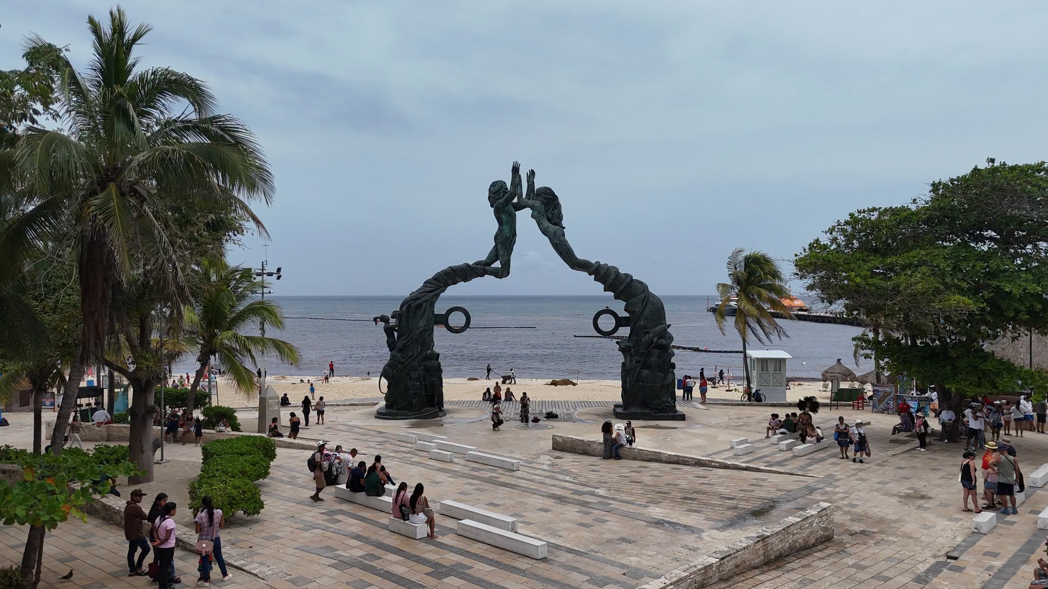
Parque Los Fundadores is where Avenida Juárez meets the sea, and it is the symbolic centre of Playa del Carmen. Its landmark is the Portal Maya, a sixteen-metre bronze sculpture unveiled in 2012, and the Voladores de Papantla perform their pole ceremony beside it. Fifth Avenue begins here, the Cozumel ferries dock at the pier alongside, and the ADO Terminal Turística, with buses to Cancún, Cancún airport and Tulum, is a few steps away, as is the Paseo del Carmen open-air shopping centre at the start of Fifth Avenue.
As a beach it is a busy, working stretch rather than a quiet one. People sit on the sand and in the park, musicians sometimes play traditional instruments, and on some days there are volleyball games.
Two factors set its sargassum record. The municipality now cleans the beach regularly, so a heavy morning is likely to have been cleared by the afternoon. At the same time, Fundadores can receive heavy sargassum on both sides of the pier, and in September and October 2026 our photographs often showed more sargassum between Fundadores and Constituyentes than further north.
- Best for
- A swim between other plans, the Portal Maya, the ferry to Cozumel
- Amenities
- The park, Fifth Avenue and the ferry terminal immediately behind the beach
- Access
- Easy: public access from Parque Fundadores or from the public beach beside it
- Watch for
- Sargassum accumulating on both sides of the ferry pier; busy, especially with local families on Sundays
- Our assessment
- Not the best beach in the area, but social and lively, with free cultural performances and a shopping centre a few steps away.
Read the full guide to Parque Fundadores → · Live card →
Beaches with recurring problems
Several well-known stretches of the town beach were left out of the ranking because of recurring problems with sargassum or erosion, although each can still be in good condition on some days.
Punta Esmeralda
Punta Esmeralda, at the northern edge of the town near Calle 110, has one of the most distinctive settings on this coast: a coastal cenote whose fresh water flows across the sand into the sea, forming a shallow channel where children play. Its sargassum record, however, has been poor. In September and October 2026, our photographs and drone flights often showed more sargassum from Playa 72 and Playa 88 to Punta Esmeralda than on the central beaches, and Punta Esmeralda was among the worst affected stretches of the town on several of those days.
Playa El Recodo (Calle 14 to 16)
El Recodo is a short, narrow stretch between Calle 14 and Calle 16, south of Constituyentes, and it is one of the places where sargassum gathers most heavily on the town beach. In January 2026, outside the main season, about a thousand tonnes came ashore between Calles 12 and 16, concentrated at El Recodo, and the clean-up had to be done largely by hand because erosion prevents machinery from reaching the sand. The beach was closed during Easter 2022 so that the sand could recover, and the municipality has since applied to Semarnat for permission to return sand to the most eroded central beaches, El Recodo among them. Loose stone in the shallows also makes entry uneven.
Playa Constituyentes
The beach at the foot of Avenida Constituyentes is one of the main public accesses in the centre. It lies just south of Mamitas and sometimes shares similar conditions, but erosion has narrowed it badly. On some days, especially at high tide, the sea reaches the rocks and almost no dry sand is left in front of the buildings.
Playa Pelícanos (Calle 44)
Pelícanos, at the end of Calle 44 Norte, is among the most erosion-prone stretches in the town. The municipality closed the access in February 2026, after strong winds and cold fronts stripped the sand back, left the access steps hanging over the water and undermined a building at the waterline. Because the erosion was caused by winter winds and waves rather than sargassum, this beach can be difficult to use even when there is no sargassum at all. The water off the nearby Avenida CTM is also a mooring area for small fishing and tour boats.
Playacar Fase 1
Fase 1 begins immediately south of the ferry pier, and that position works against it. Sargassum moving north along the coast can collect against the southern side of the pier, so this stretch often shows more sargassum in our photographs than the beaches immediately north of it. Darker water near the shore, particularly at the entrance close to Parque Fundadores, is often the first sign. The beach has also become steadily narrower with erosion, and the municipality has named the area near the Xamán-Ha pier, on the Playacar side, among the points where it plans to return sand.
The local pattern of sargassum in Playa del Carmen
Three features of the town explain most of the differences between its beaches. The first is the ferry pier, which interrupts the movement of sand and floating sargassum along the shore. The second is erosion, which has left several central stretches with little dry sand, so cleaning with machinery has to be done with care where the sand is already thin. The third is cleaning: the municipality clears the central beaches and the hotels clear their own frontages, so what a visitor sees at midday may differ from what arrived overnight.
The heaviest arrivals on this coast usually fall between May and August, and the town beach is generally at its best from December to March. Within any season, however, conditions change from one day to the next with the wind and the current.
Using this ranking
A ranking describes the character and the usual record of each beach; it cannot describe the week of a trip, and every beach has its own features that will appeal to different visitors. The most reliable way to choose a beach in Playa del Carmen on a given day is to compare the latest dated photographs of several beaches on the same morning, which the live map allows, together with the Playacar webcam and our drone footage of the town.
Conditions change quickly.